By Matthew Cumberledge, GCHS Executive Director
2020 is the census year, an important time in the United States. The census is an important tool for historians and genealogists alike, but because it happens only every ten years there are gaps in the information that we’re able to extract from these records.
The Civil War was one of these historic times whose impact cannot directly be seen in the federal census because it happened between 1861 and 1865, with the census years of 1860 and 1870 bracketing it.
Greene County is lucky in that we have a document that accurately details who was where and provides an interesting snapshot of Greene County right at the very end of the Civil War.
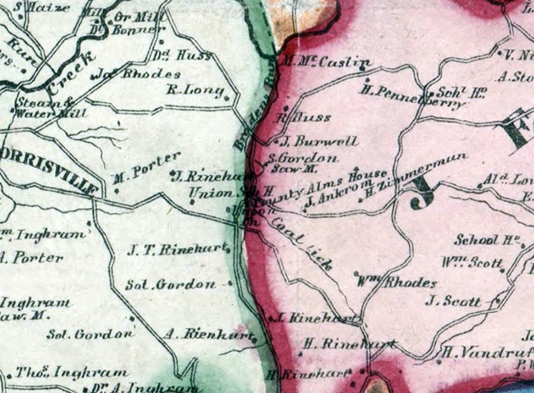
“McConnells Map of Greene County Pennsylvania, drawn from actual surveys by J. L. McConnell, G. F. Wolf and assistants, Published by Tuttle & Co, Philadelphia, Penna” in 1865 is the very document that gives us that wonderful glimpse of life in Greene County in a time so very long ago.
The map is a fold up that is bound into a small cloth booklet and shows the location of every residence in Greene County and who was living there in 1865. Beyond that however, it shows the locations of schools, churches, institutions and anything else that existed at the time.
McConnell’s map is a valuable tool, not only because it gives us information about an important time, but genealogists and historians are also able to compare the map to both the 1860 and 1870 censuses and figure out precise locations of where people lived, and make possible connections as to how people were interacting with each other and, in some cases, even solve genealogical mysteries!
In the photo, we’ve shown a detail of McConnell’s map that focuses in on the border of Franklin and Jefferson Townships. You’ll see “County Alms House” going right, near the township line, and that County Alms house is the current location of the Greene County Historical Society Museum!
If you are a researcher, and haven’t stumbled across McConnell’s map, it is an excellent resource. If you go to greeneconnections.com and click on the resources tab, you’ll find a copy under the maps section; you can also visit Cornerstone Genealogical Society’s website at cornerstonegenealogy.com and inquire about the copies of the map they have available that are in book form with an index!
Please keep an eye on the Greene County Historical Society Facebook page for our Digital Programming, and to keep up on our events and happenings as we make our way through the COVID-19 pandemic!


