W
hat’s not to love about the State Game Lands of Greene County? They are wild and wonderful, a refuge for wildlife, and protected from development by the Commonwealth as the land is allowed to return to nature. They make a patchwork of green on the official county map, their uneven edges matching surveying lines that were drawn in the 18th and 19th centuries, when every hill and valley had been cleared of virgin timber and turned into farmland. Even the steepest hillsides became pastures – this was sheep country. At one time, sheep, mostly Spanish Marino, outnumbered people and flocks grazed on nearly every bit of cleared land that was not a hayfield.
The boom years of the 1800s brought prosperity because fine wool was a hot commodity for clothing, blankets, quilt battings and Civil War uniforms. But with the advent of synthetics in the 1920s, the market shrank and steep hillsides, once manicured by flocks, began to grow back their hardwood forests of maple, oak, hickory, ash and poplar.
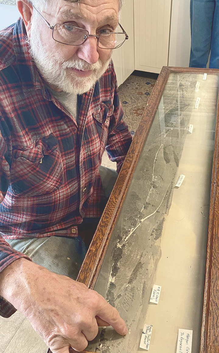
Terry Cole points to a spot on the old framed photograph on the kitchen table of his Hoovers Run home. “That’s Cephus Tustin’s farm. You can see the house. Everything along Bluff Ridge was cleared back then.” It’s startling to compare this view to the forested hillsides of today. The white ribbon of Bluff Road was once the Warrior Trail. That ancient indigenous trade and war path runs west from Greensboro through State Game Lands 223, crosses State Rt. 221 above Spraggs and then rides Bluff Ridge past Hoovers Run into Jackson Township. There it meets up with State Rt. 18 above Nettle Hill and wanders across Aleppo Township on its way to the Ohio River. The two big tracts that make up State Game Lands 179 hang on either side of the trail as it passes through Jackson Township. The land is breathtakingly steep here and hunters rarely venture beyond its narrow stream bottoms and razor back ridges. The call of the wild is growing stronger in these deep ravines – bear and bobcat are bringing back the natural order, as well as coyotes, foxes, turkeys, rabbits, muskrats, squirrels and beavers. White tail deer that were driven from the county in the 1800s made a healthy come back from Virginia and now help pay the bills on Commonwealth land with hunting fees and licenses.
The same balance is returning to the privately owned forests and bottomlands of Hoover Run. Thanks to the Cole family, who invite hunters to sleep over in rustic cabins and hunt their private preserve, families have a chance to hunt together and make memories that last a lifetime.
I’ve come to Hoover Run to find old hunting photos and talk with Terry and son Shane about hunting, family history and the reason for those jagged perimeters of the Game Lands. The state began purchasing land here in the 1970s when old farms were going cheap, Terry tells me. After World War II, sons and fathers left the farm for jobs elsewhere and those that stayed took outside jobs to earn a living. Dairy and beef cattle replaced sheep as an agri-business, but only a fraction of the remaining farmers still try to make a living off the land.
On the other hand, Terry’s family stayed put on Hoovers Run, where the family tree of Coles and Tustins planted itself in the very early 1800s. These families stuck it out through every economic boom and bust that came along. Terry, a sixth generation descendent, became a wrestling coach at Central Greene School District and kept his land in working order by creating a happy hunting ground that stretches up and down Hoovers Run to Log Cabin Road and beyond. He and Jane opened their home to hunters in 1987, then added cabins to rent and grew a fan club of satisfied customers who return year after year with their kids and grandkids to hunt these hills.
Free access to state game lands draws not just hunters, but hikers, bikers, foragers, birdwatchers and wildflower lovers into Penn’s Woods. By law, everyone wears florescent orange during hunting season. Be mindful of the rules of the hunt, published each year in the Pennsylvania Hunting and Trapping Digest, which can be picked up at most local sporting goods stores or viewed online.
PDF maps of SGLs 179 and 203 are worth tracking down on the game commission website www.pgc.pa.gov. The land is crisscrossed with state and township roads and the online maps show where it’s permissible to park and describe the terrain. The Greene County map pinpoints the 300-yard shooting range with six uncovered handicap accessible shooting benches on Rinehart Road in Jackson Township. The 100-yard range on SR 2018 is a dot on the map near historic Garards Fort and the equally historic White Covered Bridge in Greene Township.
One other cluster of green can be found on the county map where St. Rt. 21 heads for the West Virginia line. SGL 302 straddles the South Fork of Enlow Creek in Richhill Township and extends into Washington County. Hunting is considered excellent in this secluded valley and so are the spring wildflowers and the songbirds that migrate here to nest. Enlow Creek is stocked during trout season as are the creeks running through nearby Ryerson Station State Park on Bristoria Road. Portions of the park are approved for bow and rifle hunting and the park has a modern campground with RV access. FMI, go online: www.dcnr.pa.gov
